Learn about what risks Nintendo faces in it's Kyoto location.
Japan is well known for it's earthquakes. Kyoto is no exception to this perception.
Just like other parts of Japan, Typhoons are not impossible to happen in Kyoto.
Nintendo HQ is located very close to a river and can flood.
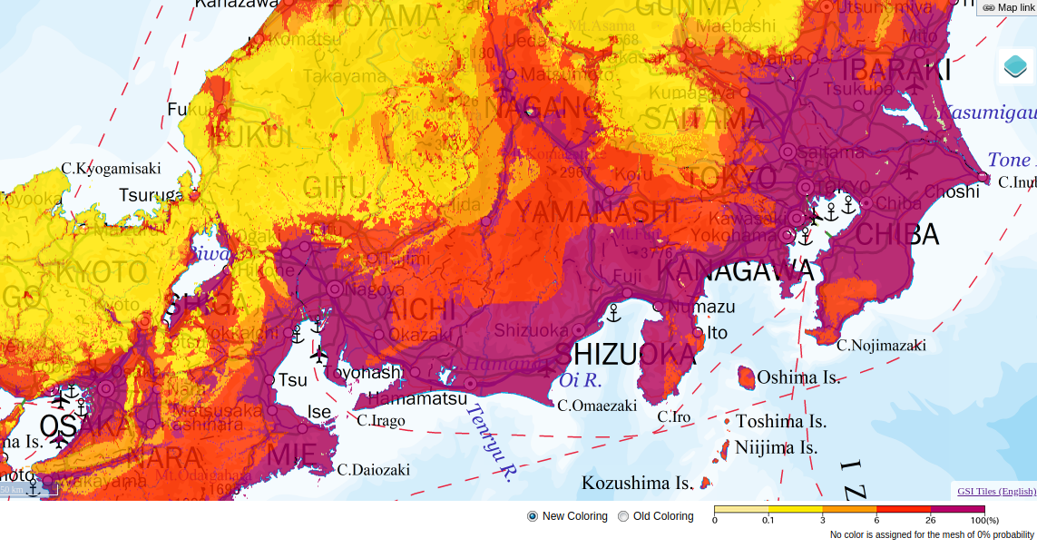
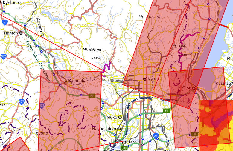
Kyoto is no exception when it comes to earthquakes. As you can see in this image, the red lines and boxes show active seismic zones and Kyoto is completely covered in this zone (J-SHIS, 2021). In fact, in 2018, Nintendo had to delay a live stream event because of a earthquake that struck the area (Nintendo of America, 2018). You can see the tweet that they sent out below.
Due to the powerful earthquake in Hokkaido, Japan, we have decided to delay this week’s planned Nintendo Direct. We will provide a new time and date in the near future. Thank you for your understanding. pic.twitter.com/IITgJFtzub
— Nintendo of America (@NintendoAmerica) September 6, 2018
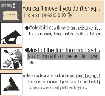
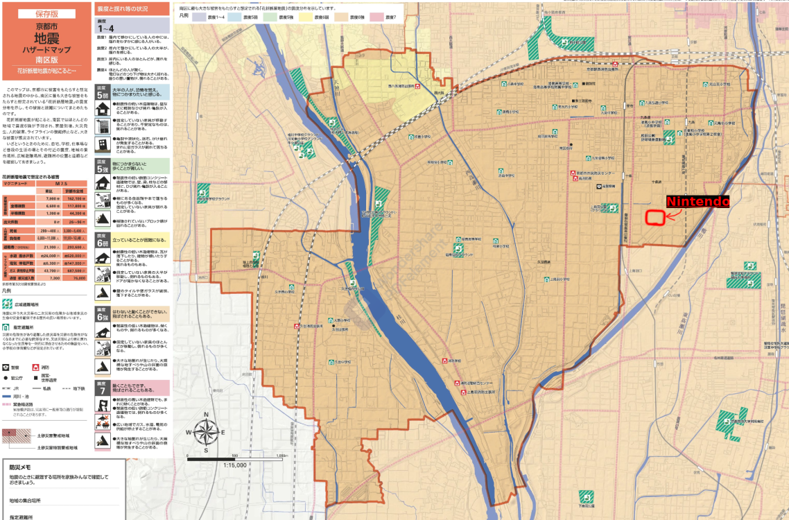
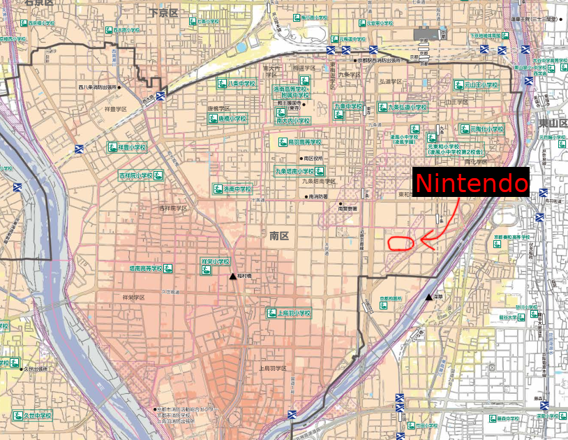
The Kyoto city government has also released an earthquake risk map that shows the most dangerous areas. When translated via translate.yandex.com/ocr, it says that the orange region is a 6 earthquake (Kyoto City, 2021). A "6-strong" earthquake is described as "You can't move ..." and "It is also possible to fly" (Kyoto City, 2021). I could not figure out if this was using the Richter scale. From the English translation it says "seismic intensity" and based on how similar the description of a 6 earthquake, I assume it is using the Richter scale (Kyoto City, 2021).
Nintendo lies within the area on the right that looks as if a square had been cut out. I have taken the liberty of editing the image to highlight where Nintendo is located.
While seeing the very alarming risk maps might scare you, it is not as bad as other parts of Japan. As you can see from the image on the left, Kyoto experiences way less earthquakes compared to the well known city of Tokyo (J-SHIS, 2021). This could very well be because Tokyo sits near many plate boundaries and Kyoto is near only one seismically active region that could be less dangerous than the plates that Tokyo sits on-top of (Hurst, 2019, p. 6).
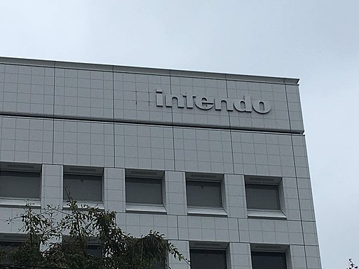
Just like the rest of Japan, Typhoons are not uncommon to the area. Japan has a long history of experiencing Typhoons and Kyoto is no exception. As you can see in this picture, the 'N' from the Nintendo logo was ripped off from typhoon Jebi that occured in 2018. (Christophe95, CC BY-SA 4.0 , via Wikimedia Commons, 2018)
Kyoto is surrounded by many sources of water such as the Katsura river, Kamo river, and lake Biwa. Nintendo is located no more than 2 blocks away from the Kamo river. In the picture, the river on the right side is the Kamo river. Because Nintendo is so close to this river, the only thing that is preventing Nintendo from flooding is the height of the river banks. As you can see from the image obtained from the Kyoto city government's website, Nintendo is located in a flood zone (Kyoto City, 2021). Any intense rainfall or storm surge that makes the river overflow will cause Nintendo to flood.
If a mass flood occurs, Kyoto City will have 121 square kilometres of the city flooded (Udmale et. al., 2019, p. 11). This can be compared to Osaka city (south of Kyoto and touching the ocean), which will have 144 square kilometres flooded (Udmale et. al., 2019, p. 11). The average inundation depth for Kyoto City is 2.4m which is about 8 feet (Udmale et. al., 2019, p. 11).
Mobirise site software - Visit site